


‘Unique’ Weather Warning for Winter As La Nina, Polar Vortex Dance
 2025 年 11 月 16 日
Meteorologists Warn of Potential “Extraordinary and Unique” Atmospheric Event Shaping the 2025-2026 Winter Outlook
A rare and significant atmospheric event may dramatically reshape the upcoming 2025-2026 winter season in the United States. Experts are closely monitoring a possible disruption of the polar vortex—a key factor in determining how cold it gets during winter—and the strengthening of La Niña conditions, which influence the movement of cold air across the continent. These changes could lead to colder and snowier weather than usual across many parts of the country.
Why It Matters
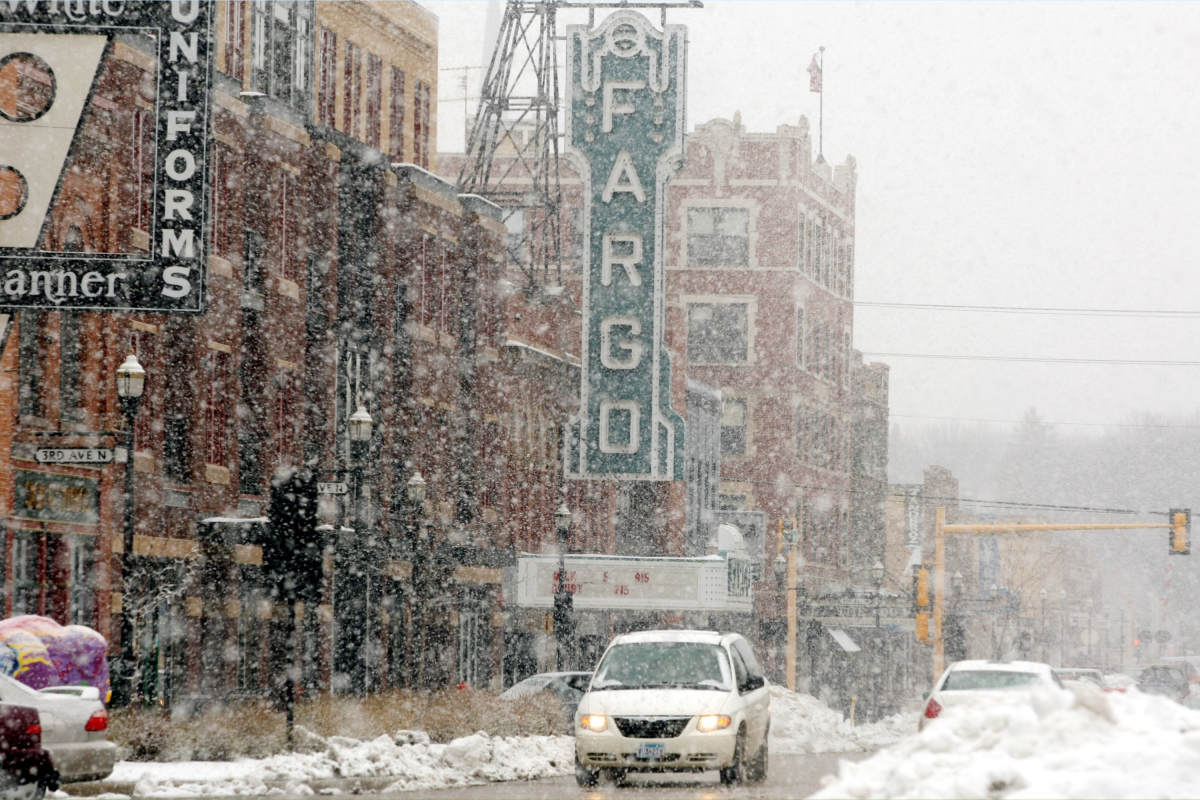
A disruption of the polar vortex could unleash a blast of frigid Arctic air into the U.S., causing below-average temperatures, heavy snowfall, and potentially dangerous wintry conditions. Unlike typical winters, this impact could start earlier than normal—beginning in December—and last longer, extending through January.
What To Know
Meteorologists and climatologists highlight two critical atmospheric patterns currently at a crossroads: La Niña and the polar vortex. Their interaction will likely determine how the winter unfolds.
One possible scenario involves a sudden stratospheric warming (SSW)—a rare and dramatic rise in temperature high above the North Pole. This warming can disrupt the polar vortex, which usually traps frigid air near the Arctic. When disturbed, the polar vortex can push cold air much further south, potentially causing extended periods of cold and snowy weather across parts of the U.S. from December through January.
Alternatively, the ongoing La Niña—defined by cooler-than-average Pacific Ocean waters—might continue to be the dominant influence. Historically, La Niña winters bring warmer conditions to the southern and eastern U.S., while the northern states experience cooler and wetter weather.
Expert Insights
Judah Cohen, a climatologist at MIT, explains:
“A sudden stratospheric warming [is] the largest type of disruption that occurs to the polar vortex. It is named because of the dramatic warming that occurs in the polar stratosphere; warming near the North Pole can exceed 100 degrees in just a few days. This warming displaces the polar vortex much further south than normal.”
Celeste Saulo, secretary-general of the World Meteorological Organization, emphasizes the importance of seasonal forecasts:
“Seasonal forecasts for El Niño and La Niña and their associated impacts on our weather are an important climate intelligence tool. They translate into millions of dollars of economic savings for key sectors like agriculture, energy, health, and transport, and have saved thousands of lives when used to guide preparedness and response actions.”
What Happens Next
The true impact of the potential sudden stratospheric warming will become clearer toward the end of November and into December. If historical patterns hold, Americans could experience an extended period of colder and snowier weather lasting into early January.
For context, a notable November SSW event in December 2000 brought nearly three weeks of subzero high temperatures and significant snowfall—up to 13.4 inches—in parts of the upper Midwest.
Stay tuned for updates as meteorologists continue to monitor these evolving atmospheric conditions that could redefine the winter season ahead.
https://www.newsweek.com/unique-weather-warning-winter-2026-la-nina-polar-vortex-11055127